

When you go to a new destination do you Google “trail walking near me” on your phone? If you do this while visiting the small town of Anacortes, Washington the search will find over a dozen trail options. But, the majority of trails on Fidalgo Island are for hikers, not walkers.
So which trails should you take if you want a flat and paved trail or an easy walking trail for steps counting? In this post, I will cover the three main walking trails in Anacortes, the Tommy Thompson Trail, Guemes Island Trail, and Rotary Park. Plus, include information about three additional trail walking options.
Discover more the area in the Anacortes travel guide.
Disclosure: You can help support my small town travels by using the affiliate links in this post. Using the link is at no additional cost to you, and provides a small commission to me to help support my blog.
Best Walking Trails in Anacortes
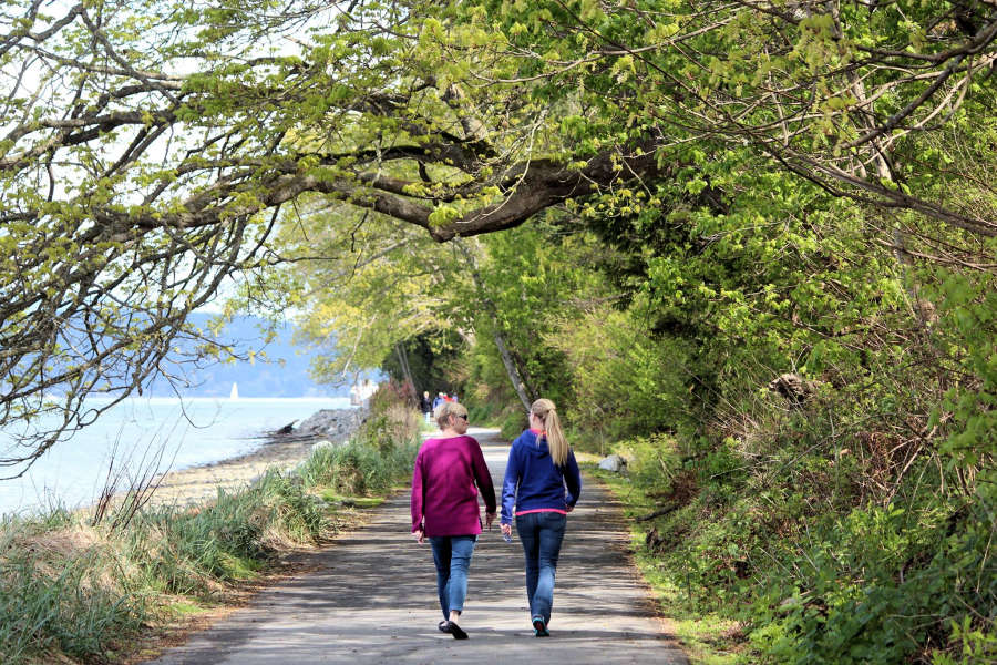
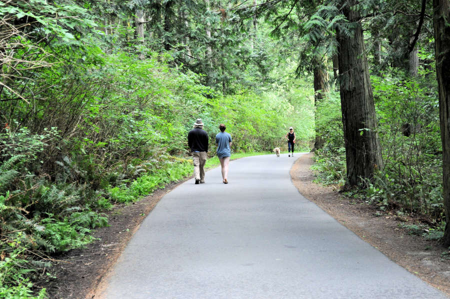
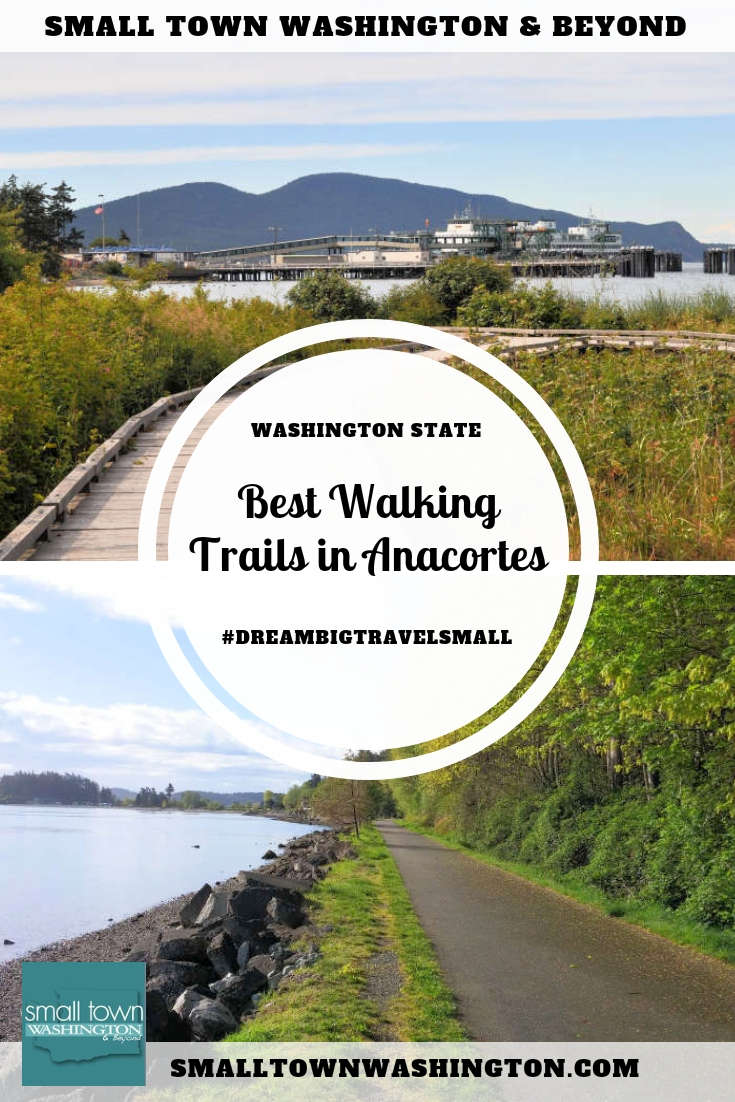
Tommy Thompson Trail
The 3.3
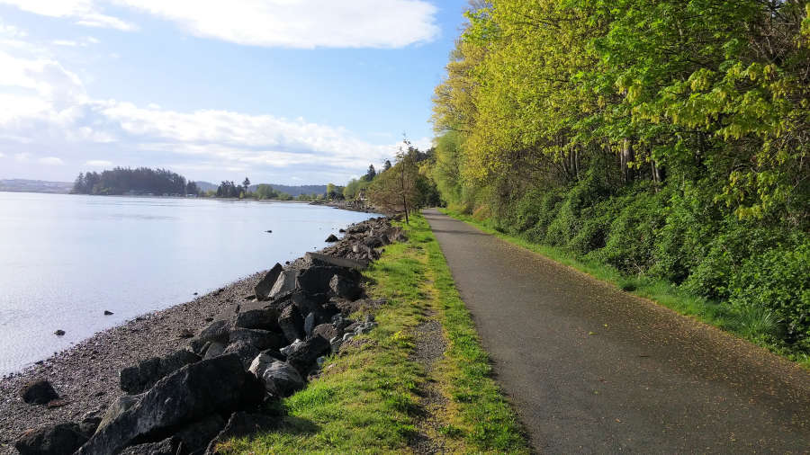
Travel tip: The trail is east facing and receives lots of morning and mid-afternoon sun. On sunny days, you’ll want a hat and sunscreen.
For most of the trail, you’ll see views of Fidalgo Bay and the Cascade Mountains, including Mount Baker on a clear day, and the refineries. Some of the highlights are crossing over a 2000-foot railroad trestle and the beaches tucked along the trail.
This trail is very popular, and you’ll see runners, walkers, bike riders as well as families and dog walkers on the trail year-round.
Travel tip: Keep your eye out for great blue herons, harbor seals, migratory waterfowl, and river otters.
Along the route are interpretive displays, murals, sculptures, and a totem pole at the RV Park. If you need a break or want to relax and enjoy the scenery, there are benches along the route.
There are several access points for the Tommy Thompson trail.
- 11th St. and Q Ave. (Across from the Safeway)
- 22nd St. and Q Ave. (small parking lot with a restroom)
- 30th St. near T Ave. (small parking lot with a restroom)
- 34 St. near V Ave. (street parking, and one of the most popular places to start the trail)
Click to find out more about the Tommy Thompson Trail on Washington Trails Association.
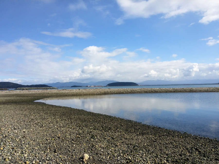
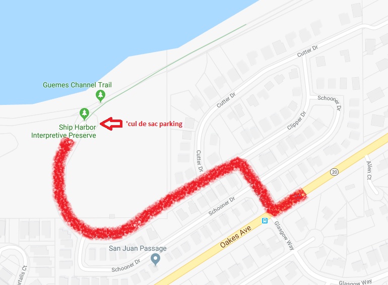
Guemes Channel Trail
The Guemes Channel Trail also follows the old railroad route, and the plan is to connect to downtown Anacortes and the Tommy Thompson Trail, and the other direction to Washington Park. You can read more about that here.
The trail is around 2 miles round trip and has views of Guemes Channel, Guemes Island, Cypress Island, and the Washington State ferry. It is also north facing, with some beach at low tide and partial shaded.
If you are unfamiliar with Anacortes, getting to the trail can be a little tricky at first.
To get there take HWY 20 (also called Oakes Ave.) along this section of road, and turn at Ship Harbor Blvd. Go straight until the road tees and take a left on Edward’s Way. Follow this road to the cul de sac where you can park, and the trail is to the right. (If you find yourself passing the road that leads to the Washington State ferry terminal, you’ve gone

Rotary Park
On the north and east side of Cap Sante Marina, Rotary Park has a short paved walk that takes about 8 minutes one-way. It is partially shaded with views of the marina and ends at a viewpoint with a gazebo that overlooks Fidalgo Bay, the jetty, and the marina. There is also access to
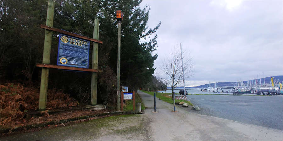
There are a couple of ways to get to Rotary Park. One is by walking around the north end of Cap Sante Marina. If the weather is nice, this is a good option, and it will extend your walk some too. The other is drive through or around the marina’s north parking lot and then park in the gravel lot next to the trail.
Optional Walking Trails
Option #1: Ship Harbor Interpretive Preserve
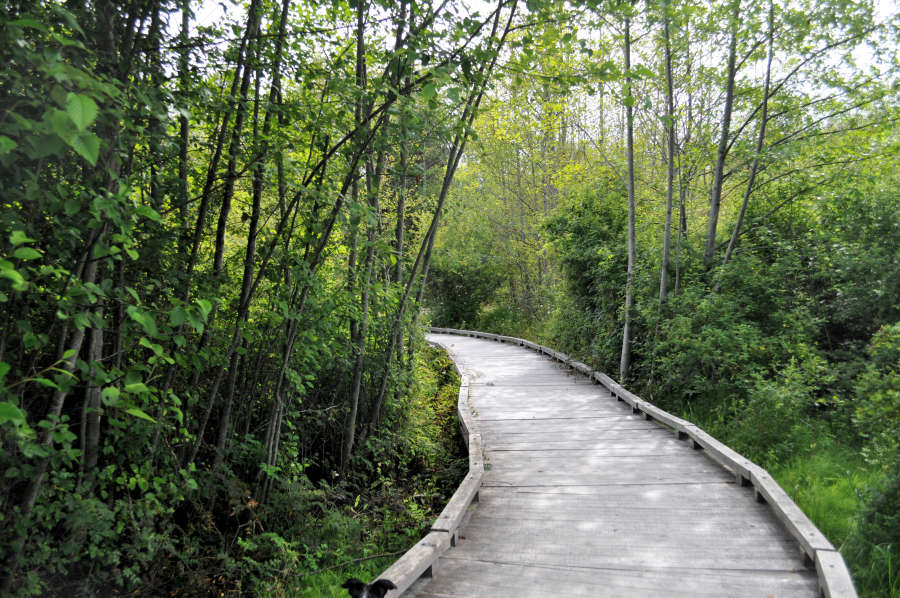
Ship Harbor Interpretive Preserve, also called SHIP Trail, is one of my favorite short trails because it has 25 acres of wetlands and a long stretch of sandy beach, as well as, the views you also get on the Guemes Channel Trail of the islands and the Washington State Ferry.
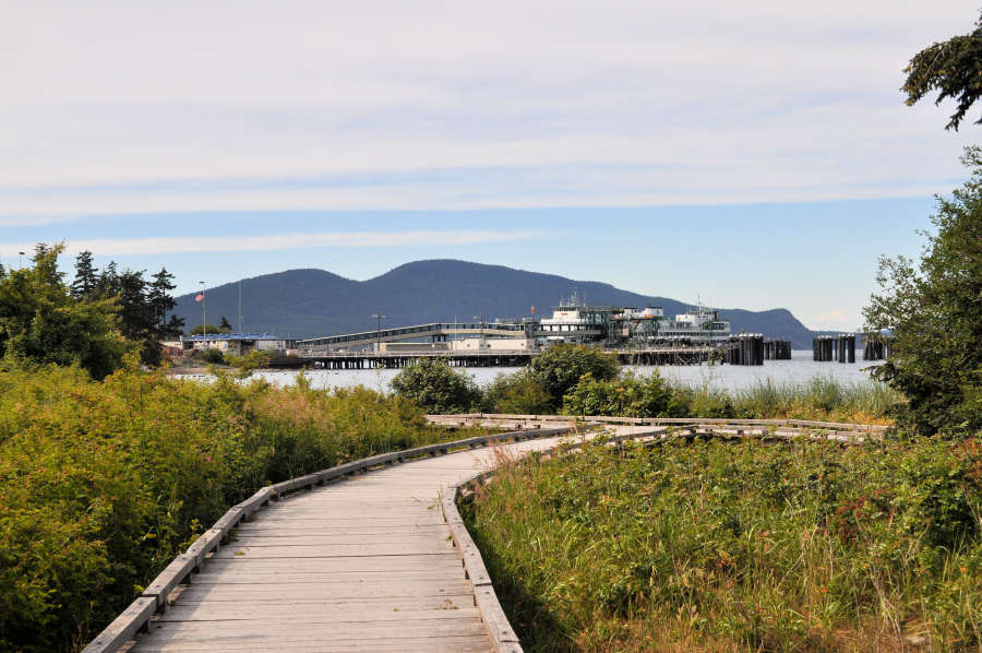
What might be a drawback for some walkers is that SHIP trail is not paved. It is mostly gravel with a section of boardwalk that leads you through the wetlands.
To get there, follow the same route to the Guemes Channel Trail and park in the cul de sac. Instead of going right, turn left, and there is the trailhead. Walking the trail takes around 15-20 minutes depending on how long you linger at the viewpoints.
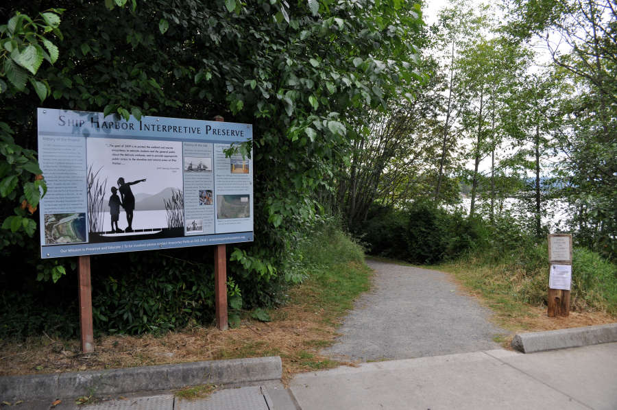
Click to read more about Ship Harbor Interpretive Preserve Trail.
Option #2: Washington Park Loop Trail
If you are looking for a paved trail, but want some inclines to pump those muscles and get the blood flowing, head to Washington Park. The paved 2.2-mile loop trail curves through the park and during certain hours cars are allowed on the road.
The north side is flat, and one could easily walk to Green Point and then turn around and walk back to the parking lot. It’s about a 10 to 15-minute walk to Green Point.
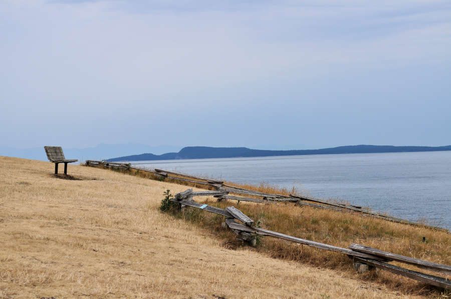
If you only want to walk the flat portion of the loop trail, turn around at Green Point, which you can see from the photo above turns brown in the summer. If you continue past Green Point, the elevation gain increases and there are ups and downs along the road.
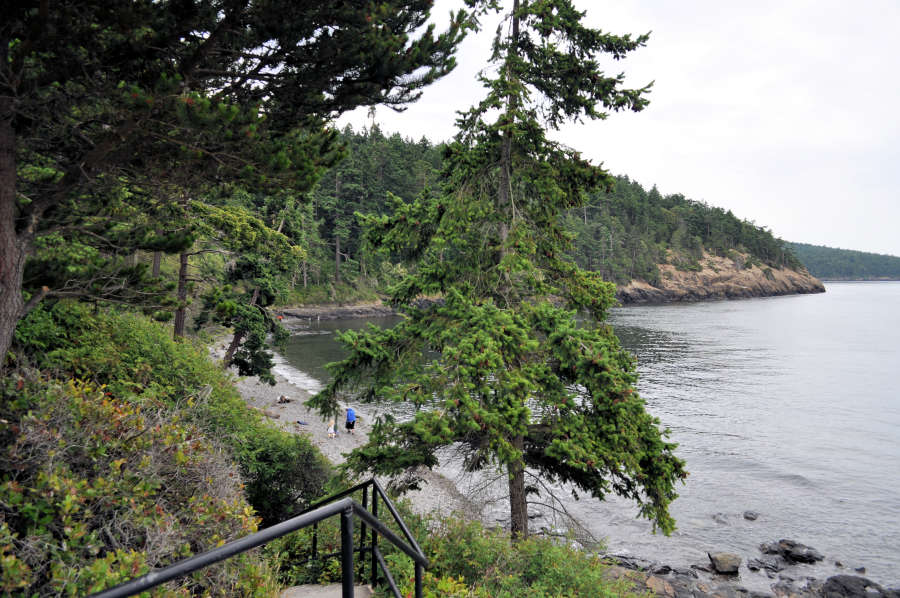
Travel tip: At the very end of Green Point, along the road, you’ll find stairs going down to a beach.
When I walk the loop, I prefer to go clockwise, as there is one long stretch of uphill road that I prefer to walk down. What is nice about Washington Park is that it has plenty of seascape vistas and views of the San Juan Islands.
Travel tip: A popular stop for photos along the Washington Loop trail is near a very striking twisted tree – you can’t miss it.
Want to hike instead of walk? Read about hiking in Anacortes.
Read more about Anacortes in this handy travel guide.
I live in Anacortes and love walking the trails here. I live near the Guemas Channel trail so walk it often. I also love all the Forest Land Trails and hike them often. I can even get to Little Cranberry without getting in my car!
Cathy, I hike the trails a ton here too! So many great trails in Anacortes. You are lucky you live so close and can walk to them without driving your car!
What a great post for finding walking trails in Anacortes. I love how you are very clear on the fact that these are flat hiking trails. These look like lovely trails to reconnect with nature (did you say herons!?) and find a bit of peacefulness.
Alison, Glad you found the post helpful. 🙂 It’s good to hike, but I like to walk on a flat trail too.
Never heard of this place but looks so amazing to visit. Love all your pictures and the way you have covered all the details. Bookmarking for future. Thanks for sharing.
Krupa, I hope you get to visit Washington State one day and head up to Anacortes. 🙂
Wow, 3 different trails in one: interpretive, wooded, and channel. That us indeed awesome!
Carol, That trail really has some great features.
I didn’t know you could do that on Google maps, I will have to check that out. It’s great that there are so many trails around here and ones that are suited to all levels of fitness and ability and still allow you to get out into nature and explore some amazing views.
Nicola, It is really nice that we have trails for different levels and moods. I hope you get to check out Anacortes one day soon!
I love hiking and try to do it in every city I visit the Tommy Thompson trail looks beautiful. I love how you can see the Casade Mountains in the back ground. I especially like how you included a map of the trails, that is extremely helpful. I have never been to Anacortes, I hope I get to visit someday.
Wendy, Great to hear you found the post helpful. I hope you make to Anacortes one day!
Awesome Post, sometimes you just need a flat easy walk so you can take your surroundings in! Well thats what I prefer! I do love a good hike but my preference is flat walks. Looks like a beautiful place with great scenery 🙂 Happy Travels 🙂
Stacey, I like to say Anacortes has a trail for every mood and skill level. 🙂
When we are away, we always look for trails or hikes nearby. That’s often a great way to explore the region and move away from touristy spots.
We found ourselves sometimes excluding moderate or difficult hikes because my kids prefer running on a flat trail! Your three suggestions look great!
Rim, That’s great to hear you like to explore the trails in a destination. Great way to experience an area and see the spots the locals love. I totally get the kids running thing. These trails are perfect for that.
I love how detailed this post is. I like easy hikes so having this list makes it easier for me to decide on a trail. The Tommy Thompson Trail sounds lovely and it would be so nice to spot some Harbor seals along the trail.
Cansy, I always see harbor seals when I am on the trail, sometimes river otters too!
Trail Walking near me is a great app. These walks in Washington look wonderful. I especially like the Guemes Channel Trail that follows the railway track.
Joanne, I hope you get to check them out one day as they are really nice walks with really great views.