
Mt Rainier is the most glaciated and one of the tallest peaks in the contiguous US.
Its prominence and isolation from other peaks make it a Washington icon, and the national park is well worth a visit.
The best way to experience Mt Rainier and the surrounding peaks is to embark on one of the best day hikes in Mt Rainier National Park — here are my seven favorites!
Best Easy Hikes in Mount Rainier National Park
Grove of the Patriarchs

Some links in this post may be affiliate links. If you make a purchase through one of these links, we may earn a small commission at no extra cost to you. Please see our disclosure policy for more detail.
Driving Directions: Drive east from Packwood on Highway 12 until the junction with SR 123. Take a left at this junction and proceed past the Ohanapecosh Visitors Center, then take a left onto Stevens Canyon Road. Parking is available in the first lot on the right.
Difficulty: Easy
Total Distance: 1.5 miles
Elevation Gain: 50 feet
The Grove of the Patriarchs is a short hike in Mt Rainier National Park through towering cedar trees. The path is flat and accessible, allowing you to spend your time looking up at the trees rather than at your feet!
There are benches scattered alongside the trail for visitors to sit and marvel at the surrounding trees. However, the best view of the trees is by laying out of the way on the path on your back and gazing up at the massive trees.
The walk through the old-growth forest surrounded by these giant trees will remind you of the history of the natural landscape and give you a glimpse into the past.
Naches Peak Loop

Driving Directions: Drive east on Highway 410 from the town of Enumclaw. After 45 miles, park at the Tipsoo Lake parking lot, where you will find the trailhead for the Naches Peak Loop.
Difficulty: Easy
Total Distance: 3.2 miles
Elevation Gain: 600 feet
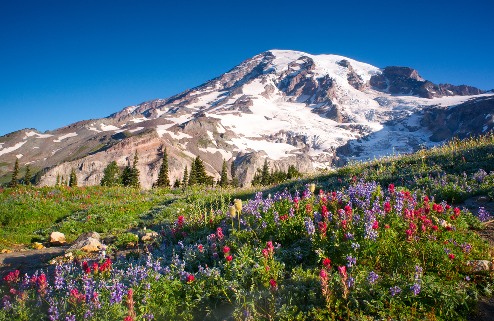
This is one of the most popular hiking trails in Mt Rainier National Park and for good reason! The loop is relatively short and mostly flat, but offers great views of Mt Rainier, lakes, and meadows.
The Naches Peak Loop is best done clockwise, so you are looking at the views of Mt Rainier instead of having them behind you. A clockwise hike begins at Tipsoo Lake and climbs up the hillside above the meadows, looks over Dewey Lake, joins with the Pacific Crest Trail, then continues down the western ridge of Naches peak and crosses SR 410 to return to the parking lot near Tipsoo Lake.
The whole area of the loop is great fun, with a few bridges crossing the small creeks in the meadow, Tipsoo and other lakes, and many views of Mt Rainier.
In late summer, the trail is lined with huckleberries ripe for picking as you hike. If you don’t know how to identify this plant, be sure to learn before you go, so you can enjoy this tasty treat during your hike.
Best Moderate Hikes in Mount Rainier National Park
Mt Fremont Lookout

Driving Directions: Drive on SR 410 43 miles past Enumclaw, then take a right at the fork with Sunrise Park Road/White River Road. Follow the road to its end at the Sunrise Visitor Center.
Difficulty: Moderate
Total Distance: 5.6 miles
Elevation Gain: 1,200 feet
The trail to Mount Fremont Lookout features a still-standing fire lookout tower and also passes by an alpine lake, Frozen Lake.
The lookout tower on the top of Mount Fremont is a two-story cabin built in 1934 originally built as a station for people to watch for fires in the nearby forests. No longer in use for this purpose, the lookout tower still stands and is occasionally used by park personnel.
To reach the lookout tower, first head towards Frozen Lake by way of the Sourdough Ridge Trail to the Frozen Lake junction. This route is 1.8 miles, leaving 1.3 miles to the lookout from the lake. Once you reach the lake, you will find the trail that continues uphill to the right to the lookout.
The beginning of this hike at the Sunrise Visitor Center is full of wildflowers in the spring and summer. As you continue along, trade the wildflowers for alpine vistas and a beautiful view of the Emmons Glacier on Mount Rainier.
Skyline Trail Loop
Driving Directions: This trail begins at the paradise Visitor Center, on the southern side of Mt Rainier. This is reached by entering Mt Rainier National Park through the Nisqually entrance along WA 706. Once entering the park, the visitor center is 16 miles down the road, where there is parking.
Difficulty: Moderate
Total Distance: 5.5 miles
Elevation Gain: 1,450 feet
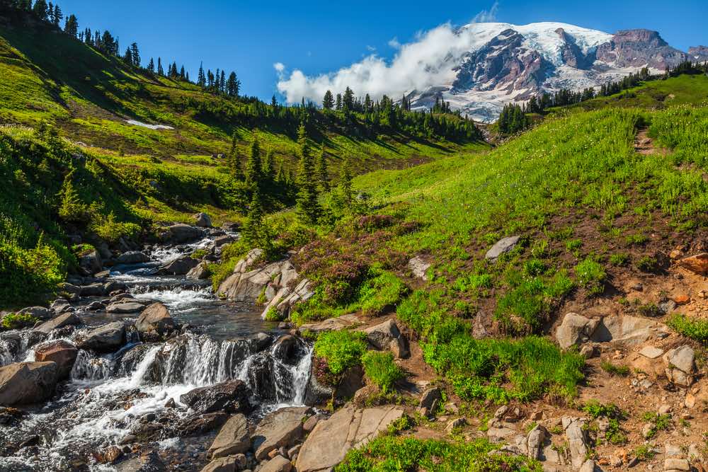
The Skyline Trail is the most popular hiking route from the Paradise Visitor Center. This Mount Rainier hiking trail is one of the most popular hikes in any of the national parks in Washington State for good reason, as the route passes by waterfalls, glaciers, and alpine meadows.
There is plenty of signage in this area to help you find the trail, but there are many intertwined paths near the parking lot, so take a moment to review the maps before heading out.
This trail is a loop that can be hiked in either direction, but if you choose a counterclockwise adventure, you will avoid the steep uphill section that faces the clockwise hiker and save the best views for the second half of your hike.
This close-up views of Rainier and the frequent marmot sightings along this trail are the reasons this trail is so popular and make it a great choice for you as well.
Rampart Ridge Loop

Driving Distance: This trail begins at the Longmire area of Mt Rainier National Park, reached by entering the park through the Nisqually entrance. Parking is available near Longmire, and the trailhead is across the highway.
Difficulty: Moderate
Total Distance: 4.5 miles
Elevation Gain: 1,300 feet
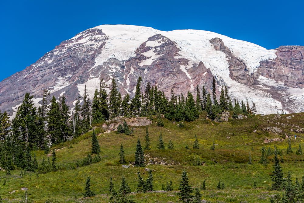
Starting from the Longmire area of the park, this Mount Rainier hike has the potential to be less crowded than hikes that begin at either the main Sunrise or Paradise areas.
Less crowded, but not at all less beautiful than hikes that begin in other areas of the park, Rampart Ridge offers beautiful views of the surrounding forest and Mount Rainier.
This trail begins by wandering through a swampy area full of large trees. Depending on when you hike, you may also enjoy the pungent smell of Skunk cabbage, a native swamp plant that is named after its smell. You can spot this plant by its large green leaves and when it is flowering, large yellow blooms.
Past the swamp, the trail climbs through the forest, giving you a view of the buildings down by Longmire – where you started. Upon reaching the ridge you will find a view of Mount Rainier, before traversing the ridgeline down to the Wonderland Trail. At the Wonderland Trail, turn right, and continue until you reach the Longmire parking area again.
Best Difficult Hikes in Mount Rainier National Park
Moraine Trail
Difficulty: Difficult
Driving Directions: This trail begins at the Paradise Visitor Center within Mt Rainier National Park. The visitor center is accessed by the Nisqually entrance to the park, and continuing on the park road until reaching the visitor center at the road’s end.
Total Distance: 2.2 miles
Elevation Gain: 400 feet
The Moraine trail takes you up from the alpine meadows to the moraine, the accumulations dirt and rock that is pushed by a glacier as it moves, left by the Nisqually Glacier. It will also take you out of the crowds at Paradise onto a seldom-trafficked trail.
The Moraine trail is not maintained, and it can be steep and slippery, so watch your feet and turn back if you are unsure of your abilities.
The Moraine trail begins at the stone staircase near the Paradise Visitor Center featuring the John Muir quote: “…the most luxuriant and the most extravagantly beautiful of all the alpine gardens I ever beheld in all my mountain-top wanderings.”
However, there are plenty of trails that begin at this point, and it is worthwhile to obtain a map of the trails from the visitor center or the information signs in the area before beginning.
To hike the Moraine trail, you will begin on the staircase and continue until the sign for the Deadhorse Creek Trail points you left, then take another left once you reach the Deadhorse Creek Trail. In a few hundred feet, you will then see a sign for the Moraine Trail.
When the trail divides as it descends with the ridge on your right, keep right. The left trail is steep and unsafe and best avoided.
At the end of the trail, you will be rewarded for your hard efforts with a close-up view of the Nisqually Glacier and the landscape it has shaped.
Burrough Mountain Trail
Driving Directions: The trail begins at the Sunrise parking lot. Sunrise is accessed from the White River entrance to Mt Rainier National Park; continue the road to its end.
Difficulty: Difficult
Total Distance: 9 miles
Elevation Gain: 2,500 feet
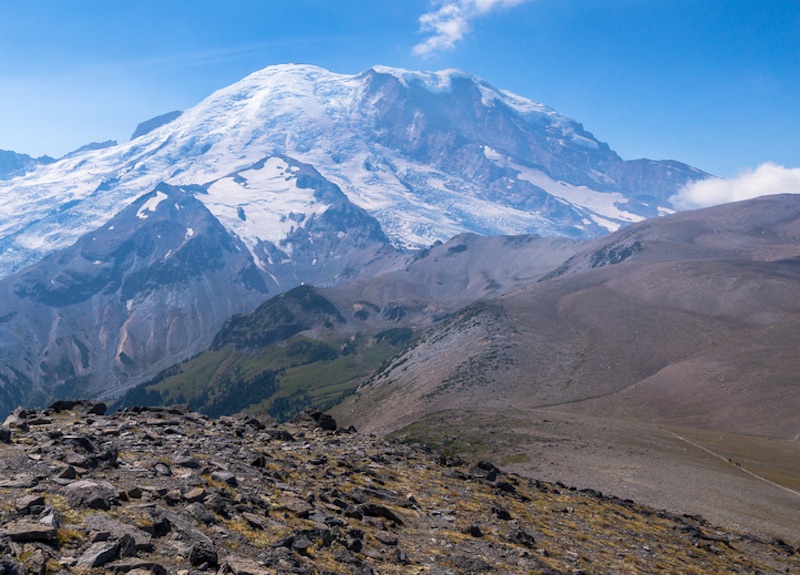
The Burroughs are three mountains snug against Mt Rainier near the Winthrop Glacier. They are barren and broad, unlike most of the mountains in the area, which provides a clear view of Mt Rainier.
Hiking the Burroughs Mountain Trail will take you to the top of as many as three Burrough Mountains. Burrough Mountain is first, at 4.7 miles roundtrip, Second Burroughs next, at 6 miles roundtrip, and Third Burroughs is the full 9 mile trip.
With each Burrough you ascend, the views improve and your distance from Mt Rainier decreases. At Third Burroughs you have an unobstructed view of the mountain and may even see climbers aiming for the summit.
For a shorter trip, both First and Second Burroughs also make excellent turnaround points, with views that will not disappoint of Mt Rainier and the surrounding mountains.

