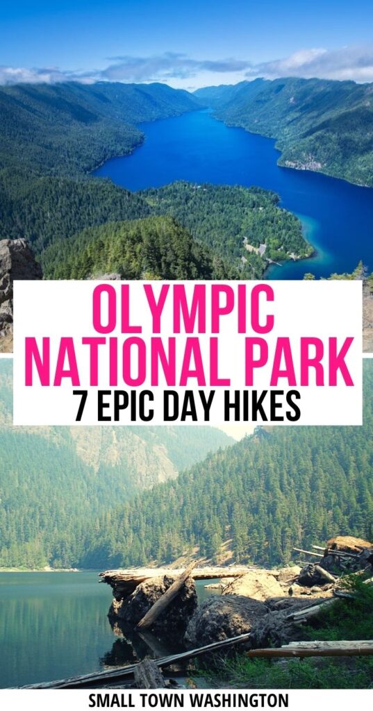
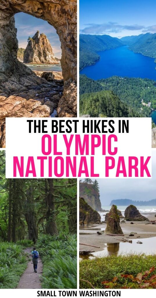
Olympic National Park is full of diverse ecosystems worth visiting, including temperate rainforest, alpine scenery, and coastal beaches.
Each of these regions provide a multitude of opportunities for hiking within the park for hikers of all abilities.
Here are a few of my favorite day hikes in Olympic National Park, suited for hikers of all different levels.
Easy Day Hikes in Olympic National Park
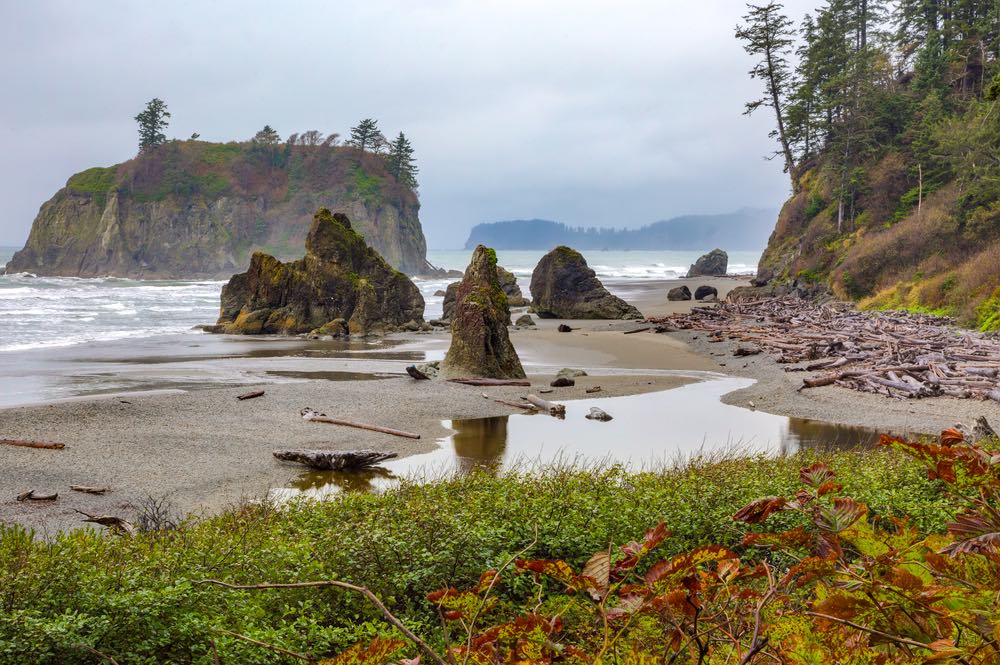
Ruby Beach
Some links in this post may be affiliate links. If you make a purchase through one of these links, we may earn a small commission at no extra cost to you. Please see our disclosure policy for more detail.
Driving Directions: Ruby Beach is accessible off Highway 101 just south of mile marker 165. There is signage pointing towards the parking lot.
Rating: Easy
Roundtrip Distance: 6 miles
Elevation Gain: 60 feet
Ruby Beach provides an excellent place for a beach stroll. Although there are at least 6 miles to explore, this beautiful Olympic National Park hike can be extended or shortened as needed.
There is an initial quarter-mile walk down the hillside to reach the beach along a gentle path. Once you reach the beach, you can walk in either direction. Three miles north of the parking lot, you will find the Hoh River flowing into the ocean.
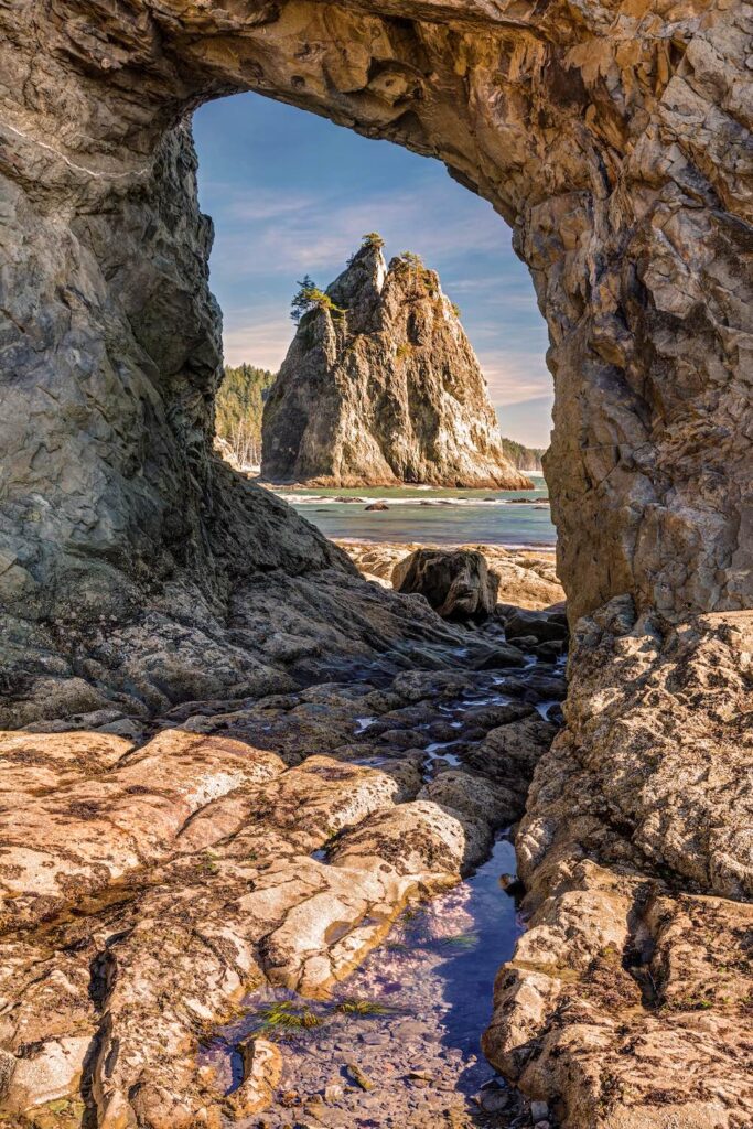
Ruby Beach features rock outcroppings and islands in the ocean, in addition to beach rocks and driftwood.
The rock formations that line the beach create many tide pools that are home to a variety of marine life. These tide pools can be explored at low tide — remember to look but don’t touch, as the sea life here is not adapted to human interference.
At low tide, it is also possible to walk out to Abbey Island, just make sure to make sure the tide doesn’t cut off your path back to shore.
Hurricane Hill
Driving Directions: Turn off Highway 101 onto Race Street toward Hurricane Ridge Road. Continue past the Olympic National Park Visitors Center up Hurricane Ridge Road to the Hurricane Ridge Visitors Center. The trailhead is at the end of the road at the parking lot.
Rating: Easy
Roundtrip Distance: 3 miles
Elevation Gain: 650 feet
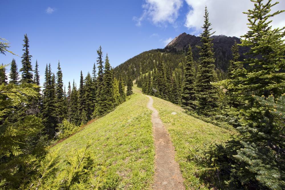
Hurricane Hill is an easy hike within the Elwha area of Olympic National Park
The hike begins with expansive views from the parking lot, travels through open forests, and ends at the summit of Hurricane Hill.
The summit of Hurricane Hill has even better views than the parking lot: you’ll see all of the Bailey Range, Port Angeles, and even out to Vancouver Island on a clear day.
Along the way, the hike switchbacks at a moderate grade on the wide trail and travels through the grassy hilltop of Hurricane Hill.
This Olympic National Park hike is best done in summer, as the road to Hurricane Ridge closes in the winter.
Moderate Day Hikes in Olympic National Park
Hole-in-the-Wall
Driving Directions: Drive west along US 101 from Port Angeles for 55 miles. Then turn onto SR-110 west, continue 8 miles, take a right onto Mora Road, and drive 5 miles to the Rialto Beach parking lot.
Rating: Moderate
Roundtrip Distance: 4 miles
Elevation Gain: 0 feet
A hike to Hole-in-the-Wall along the coastal shoreline is another beautiful part of Olympic National Park worth exploring.
The Hole-in-the-Wall is a rock formation along the shore, where a rock juts out from the headland with a hole through the middle that is large enough to walk through. It’s a photographer’s dream! Adjacent to the rock formation are tide pools full of marine life.
The hike to Hole-in-the-Wall begins at the parking lot for Rialto Beach and continues along the beach for 2 miles north.
This hike is accessible in all seasons, on both a warm summer day and a cold, wet winter day. (In fact, I picked it as one of my favorite winter hikes in Washington State).
On a summer day, expect to share the beach with a good number of other people. Luckily, the accessible shoreline means there is plenty of room for everyone, although parking may be tight.
The hike to Hole-in-the-Wall is best done at low tide, which allows access through the “hole”, and the best viewing of the tide pools. If the tide is high and walking around the headland is inaccessible, there is a path over the headland; however, it is steep and eroded.
To extend the hike, you can continue down the shoreline past the Hole-in-the-Wall, or bring camping supplies and camp for the night on the beach (with a permit).
Klahhane Ridge
Driving Directions: From Port Angeles, drive south on Race Street for 1 mile towards Hurricane Ridge Road. Drive for 15 miles on Hurricane Ridge Road to the parking lot for Switchback Trail.
Rating: Moderate
Roundtrip Distance: 5 miles
Elevation Gain: 1,700 feet
Klahhane Ridge provides a great view in all directions – the Olympics, the Strait of Juan de Fuca, Canada, and the ocean.
There are multiple trails up to Klahhane Ridge, but this route starting at the Switchback Trail is the most direct.
Although direct, this particular hiking trail in Olympic National Park gains elevation quickly in the first 1.5 miles, before the junction with the Heather Park Loop trail on the ridge.
Once you arrive at the junction, the trail follows the ridge and proceeds through open meadows surrounded by pine trees.
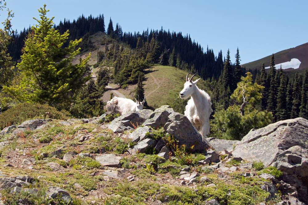
In spring and summer, these meadows are filled with the brilliant colors of wildflowers, such as paintbrush, lupine, and lilies. Bears, deer, and marmot also frequently visit this area, and you may spot them in the meadow.
The 5-mile route continues for 1 mile past the initial junction, through the relatively flat meadows, up another climb to Victor Pass, along the Klahhane Ridge, and ending before the trail heads back down towards Lake Angeles. The high point on this trail makes a great lunch spot with 360-views.
This Olympic National Park hiking trail is also frequently attempted in the winter, although you will need to consider the weather conditions and call the park to check the road closures.
Lena Lake
Driving Directions: Drive north on Highway 101 from Hamma Hamma until you reach Hamma Hamma River Road/ Forest Road 25. Take a left here, and drive 7.5 miles to the trailhead.
Rating: Moderate
Roundtrip Distance: 7 miles
Elevation Gain: 1,300 feet
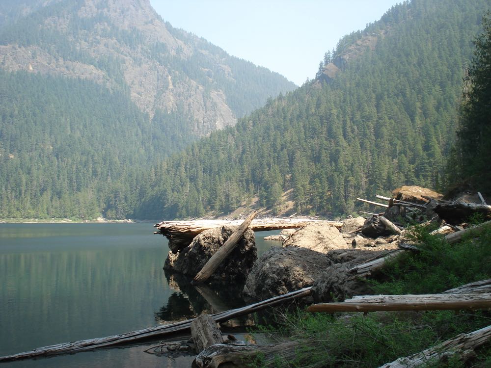
The hike out to Lena Lake is a well-maintained trail that leads to a gorgeous alpine lake.
The trail is easy enough for most hikers with its gentle switchbacks through the forest, though it is long enough and with enough altitude gain to be considered a moderately rated hike.
The trail follows Lena Creek and its waterfalls for a while, until the trail diverges from the creek. The forest surrounding the trail is old-growth, with huge trees and lush, green moss.
If the creek and forest weren’t enough, the trail also has multiple bridges crossing the creek, and the lake as the destination.
The hike to Lena Lake is a beautiful day hike, although a bit crowded. To venture further out and find more solitude, the trip can be extended to Upper Lena Lake by continuing on the same trail for another 3.5 miles.
A hike out to Upper Lena Lake is more difficult at 14 miles and 3,900 feet of elevation gain, which would firmly put it in the ‘difficult hikes in Olympic National Park’ category!
The longer trek is worth it though, as the upper lake offers more solitude and an even more beautiful alpine lake.
A day trip out to Upper Lena Lake is a long hike, but there are numerous campsites available at the lower Lena Lake. Campsites at the lower lake often fill up quickly during summer months, so make sure to arrive early if you plan to camp.
Alternatively, you can proceed to the Upper Lena Lake to camp if you obtain a backcountry camping permit online before your trip. Learn more about how to get one here.
Difficult Day Hikes in Olympic National Park
Hoh River Trail to 5-Mile Island
Driving Directions: Drive south on Highway 101 from Forks for 13 miles until you reach Upper Hoh Road. Turn east at Upper Hoh Road and drive for 18 miles to the end of the road to the ranger station.
Rating: Difficult
Roundtrip Distance: 10.6 miles
Elevation Gain: 300 feet
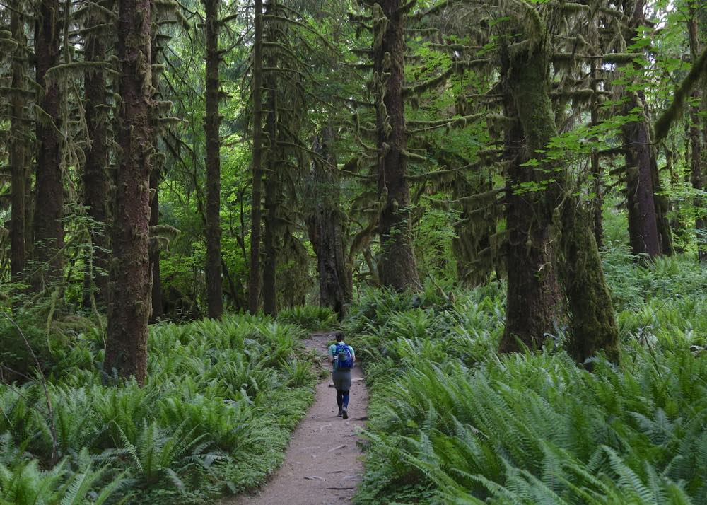
The Hoh River Trail follows the Hoh River through the lush green Hoh Rainforest.
The trail itself continues for 18 miles towards Mt. Olympus, but a hike to 5-Mile Island is a great day hike.
The difficulty rating is due to the length, but you can make it a shorter hike if you want to experience Hoh Rainforest without clocking 10 miles: just turn back at an earlier point on the trail.
The trail goes through the damp, old-growth forest, full of mushrooms and moss hanging off the trees.
Along the way, you will be paralleling the Hoh River, and you’ll be able to hear the river rushing past.
You may also see a variety of birds and Roosevelt elk throughout the forest. The open canopy affords you a great view of the forest life in the only rainforest in the contiguous United States.
At Five Mile Island, a gap in the forest allows you a view of the nearby Bogachiel Peak.
Mt. Storm King
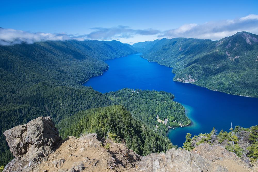
Driving Directions: Turn off Highway 101 at milepost 228 into the Lake Crescent/Marymere Falls parking area. The trailhead begins near the Storm King Ranger Station on the Marymere Falls Nature Trail.
Rating: Difficult
Roundtrip Distance: 4 miles
Elevation Gain: 2,065 feet
The hike up to Mt Storm King is well-known for its view of Lake Crescent and the surrounding hills from the summit.
The hike itself is steep at times, and the trail is not maintained to the top. The maintained trail continues 1.5 miles from the trailhead.
At this point, the route to the summit follows a climber’s trail – meaning the trail becomes more exposed and eroded.
There are ropes in some sections to aid climbing up and down, but be careful with your footing, and stop if you are uncomfortable about traveling down the slopes.
The trail to the summit is 2 miles, but there are many great viewpoints along the way if you’d rather not travel up the unmaintained trail. At the end of the maintained trail there is a view through the trees of Lake Crescent and the Strait of Juan de Fuca.
These views are the reason why this is one of the best hikes in Olympic National Park, despite the hard climb!