
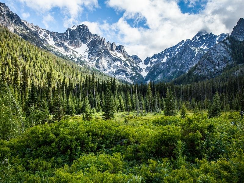
The Bavarian town of Leavenworth is located in the midst of beautiful alpine mountains and lakes, making it a great base camp for day hikes.
While Leavenworth is a popular gateway to one of Washington’s most famous hikes, the Enchantments, that hike is a challenging multi-day backpacking trail that shouldn’t be attempted as a day thru-hike unless you are a seriously advanced hiker.
Luckily, even if you aren’t able to snag one of the coveted Enchantments permits, there are still plenty of wonderful Leavenworth hikes better suited for a day trip or for beginner and intermediate hikers.
Here are some of the best day hikes near Leavenworth.
Easy Leavenworth Hikes
Icicle Gorge Nature Loop

Some links in this post may be affiliate links. If you make a purchase through one of these links, we may earn a small commission at no extra cost to you. Please see our disclosure policy for more detail.
Driving Directions: Driving east over Highway 2, take a right on Icicle Road, just before you enter Leavenworth. Continue on Icicle Road for 15.5 miles. The pavement continues for 12.5 miles and the remaining 3 miles are gravel. The gravel is generally passable for all cars, but can be washboard and potholed, depending on the season.
Distance: 4.2 miles
Elevation Gain: 150 feet
Difficulty: Easy
The Icicle Gorge Trail is one of the most popular hiking trails in Leavenworth for good reason, as it is an easily accessible trail that explores the beautiful Icicle Creek Valley.
This nature loop has interpretive signage along the way, and it has great views of the creek and forest.
Even better, the trail is nice and flat and crosses multiple wooden bridges as it meanders across Boggy, Jack, and Trout Creeks.
About halfway through the trail, the trail passes through Rock Creek Campground where there are picnic benches and restrooms.
If you are planning a picnic lunch, stop at the picnic benches near the parking lot at the beginning or end of your Leavenworth hike instead – these overlook Icicle Creek.
Blackbird Island

Driving Directions: This hike is located in downtown Leavenworth. Driving east on Highway 2, turn right on 9th street and follow the road until it intersects Main Street. Turn left at the intersection and drive down to the parking lot. Follow the trails to the right to reach Blackbird Island.
Distance: 2 miles
Elevation Gain: 100 feet
Difficulty: Easy
Blackbird island is an island in the waterfront park of Leavenworth. Although a short hike, this is a great location for a short stroll during your visit to the town, or as you are driving through to the other side of the mountains.
This path is adjacent to the Wenatchee River, a flowing, sometimes loud river. Besides the river, there are lagoon areas alongside the trail that are great for exploring.
The path may take until mid-summer to melt out from the snowfall, but a pair of microspikes and waterproof boots make it accessible year-round. Sometimes the main trail is cleared from snow during the winter – if you catch it after clearing, it’s likely to just have a small layer of snow.
If you continue past Blackbird Island, you will reach Enchantment Park, a town park with sports fields and a playground.
Moderate Levenworth Hikes
Eightmile Lake
Driving Directions: From the western side of Leavenworth turn right onto Icicle Road from Highway 2. Go down this road 8.5 miles, then turn left onto Forest Service Road 7601. The parking lot for the trailhead is 3 miles down FR 7601.
Distance: 6.5 miles
Elevation Gain: 1,300 feet
Difficulty: Moderate
Eightmile Lake is a gem of a hike in the Alpine Lakes Wilderness, and one of the beautiful lakes accessible from the town of Leavenworth.
Eightmile Lake is part of the Enchantments permit area for overnight camping, but day trips only require self-registration at the trailhead. Unlike the other Enchantment lakes, the trail to Eightmile Lake is not part of the thru-hike.
The trail begins with a steep uphill climb, but then calms down as you proceed, and the rest of the elevation is distributed along the remaining trail.
The trail begins by crossing a few small creeks, then passes through a burnt forest filled with wildflowers. After hiking 3 miles, you will reach Little Eightmile Lake, a boulder field, Eightmile Creek, then Eightmile Creek.
Mt McCausland

Driving Directions: The most popular route to Mt McCausland begins at the Smithbrook Trailhead. This trailhead is accessed off of Highway 2. Coming from Leavenworth, take Highway 2 west. Just before the pass, look for signs for NF-6700 on the left. Take this road approximately 3 miles until the trailhead.
Distance: 7 miles
Elevation Gain: 1,800 feet
Difficulty: Moderate
The Smithbrook trailhead begins in a patch of tall fireweed before the path climbs switchbacks up the hill. The switchbacks are moderately graded, making this uphill climb easier than you might imagine.
Once you arrive at the top of the hill, the trail reaches an intersection, where you will take a left onto the southbound PCT. At this intersection, the forest opens up to views of the valley and the rocky walls.
At three miles from the trailhead, before the trail drops down to Lake Valhalla, there is a turn-off for Mt. McCausland. The turn-off is unmarked, but you will know you are on the right trail if you are climbing steeply up the nearest peak.
The trail up this last stretch is not as nicely maintained as the trail below, but the views are worth the effort. Hiking poles may help with the steep trail and loose dirt.
After climbing Mt. McCausland to enjoy the views, Lake Valhalla makes a nice stop to cool off.
For a one-way hike, you could return by the trail described in the route to Lake Valhalla above, and leave a car at each trailhead. This route would be approximately 9.5 miles and you would enjoy new scenery on your return hike. You could also just drive one car and find a ride to your starting point – for this approach it would be best to end your hike at the Smithbrook trailhead and find another hiker returning to the freeway.
Challenging Leavenworth Hikes
Fourth of July Creek
Driving Directions: Driving east over Highway 2, take a right on Icicle Road, just before you enter Leavenworth. Continue on Icicle Road for 9.5 miles until you reach the Fourth of July trailhead pullout on the right.
Distance: 12 miles
Elevation Gain: 4,370 feet
Difficulty: Difficult
This route takes the Fourth of July Creek trail up to Icicle Ridge. There are several trails that connect up to Icicle Ridge, a breathtaking ridge above Leavenworth overlooking the surrounding mountains, and this one meets up with the ridge right next to the high point of Icicle Ridge.
The trail is full of color with wildflowers in the springtime! As you go up, you will find lupine, penstemon, paintbrush, and glacier lilies – among many other colors.
The trail climbs steeply as it ascends the ridge, relenting very little until you reach it. The climb can be hot and sunny, so make sure to bring plenty of water.
Although difficult, the view at the top and the wildflowers make this Leavenworth hike well worth the effort!
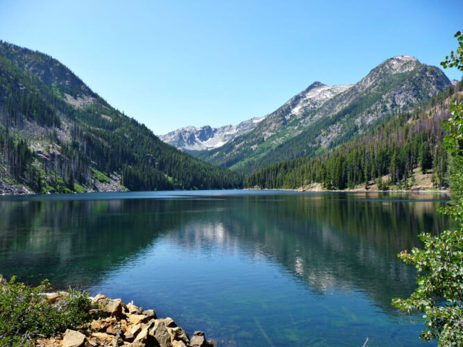
Lake Valhalla

Driving Directions: This trail begins at the Pacific Crest north trailhead out of Stevens Pass. To reach this trailhead, take Highway 2 to Stevens Pass. Driving east, take a left turn onto FR 6700 which is well-marked, 3.5 miles east of the pass. The trail starts at the edge of Lot D – the opposite side of the Skyline Lake trail.
Distance: 12 miles
Elevation Gain: 1,500 ft
Difficulty: Difficult
Lake Valhalla is a beautiful hike along the Pacific Crest Trail (PCT).
The PCT is very well-maintained trail with a gentle grade. In August and September, you may encounter thru-hikers who are traveling along the PCT from the Mexican Border to the Canadian Border. For thru-hikers that have made it this far, this is one of the last stretches of trail.
From the parking lot, the trail begins with a gentle descent for the first two miles, losing 200 feet. Along this stretch, the trail passes through the forest.
After this stretch, the trail begins to climb gently, and continues until you reach the trail just above the lake.
As you ascend, you will transition from the tall dense forest into the alpine heather and huckleberry bushes.
At the top of the pass when you spot the lake, take the trail down to the lakeshore. After coming this way, enjoy your lunch break near this sparkling alpine lake.
Pear Lake

Driving Directions: From Leavenworth, drive west along Highway 2 for 15 miles until you reach Highway 207 (Little Wenatchee River Road). Follow Little Wenatchee River Road as it turns left and becomes NF-6701, then FR 6701-500 towards Top Lake. In 4 miles after this split, you will reach the trailhead.
Distance: 13 miles
Elevation Gain: 2,200 feet
Difficulty: Difficult
A trip to Pear Lake rewards you with a sparsely visited alpine lake or two.
At its beginning, the trail could use some maintenance, and the vegetation and mud may pose an annoyance until the trail clears as you ascend. Next passing through a burn area, the trail requires visitors to embrace the alternative beauty until you reach the viewpoint of the valley.
Beyond the first view of the valley, the meadows filled with wildflowers and trees offer more of the typical alpine beauty. The trail to Pear Lake passes Top Lake on the way, a bountiful location for huckleberries in early fall.
Past Top Lake, you will join the PCT trail for less than a mile until you reach a side trail out to Pear Lake. There are campsites here for those who want to spend the night at this lovely alpine lake.

