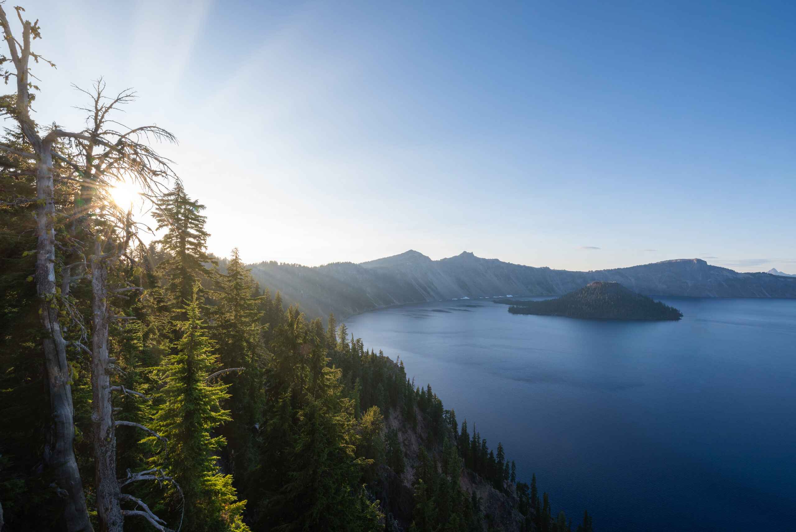
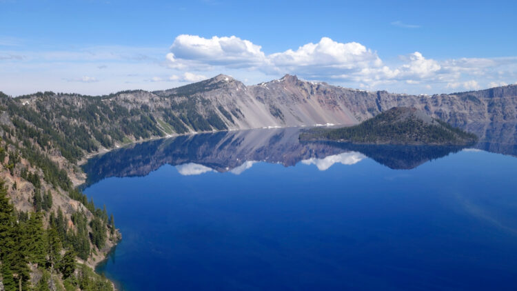
Formed thousands of years ago by a massive eruption, the beautiful and pristine Crater Lake is nestled right at the top of a volcano in the crater it left behind, and the resulting Crater Lake hikes are an absolute delight!
This is the deepest lake in the United States and boasts some of the cleanest waters on earth, which are fed entirely by rain and snow. The only way to truly experience this fantastic, picture-perfect area is to explore the best Crater Lake hikes.
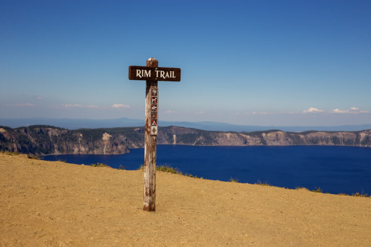
Crater Lake National park is a beautiful mix of open peaks and old growth forest. Some of the trails are exposed to the heat of the sun with little option for shade, so a hat, sunscreen, and plenty of water are highly suggested.
Some links in this post may be affiliate links. If you make a purchase through one of these links, we may earn a small commission at no extra cost to you. Please see our disclosure policy for more detail.
If you’re visiting Crater Lake in winter, a blanket of snow closes many roads and trails, but the lake and surrounding area are still well worth the visit. Stay updated on what is open through the official website and always be prepared for extreme weather conditions.
A park pass is required upon entry of the park, they can be purchased before hand or at the park entrance.
Prices depend on the type of vehicle entering, with a reduced price for cyclists or for multiple-day hikers passing through. A yearly pass is also available. Maps and daily schedules of activities are available at any ranger building and at all entry points.
Here are the best hikes in Crater Lake National Park!
Castle Crest Wildflower Trail
Difficulty: Easy
Length: 0.4 miles
Elevation Gain: 120 ft
Location: Off Volcanic Legacy Scenic Byway.
This beautiful and short interpretational trail is a must do when visiting the park, while also perfect for casual visitors and children. It wanders through a meadow with the best display of wild flowers in the area.
This garden is not only beautiful but informative as there is a self-guided tour and flowers are labeled for identification.

Sun Notch
Difficulty: Easy
Length: 0.5 miles
Elevation Gain: 130 ft
Location: Off the Rim Road, south side of Crater Lake.
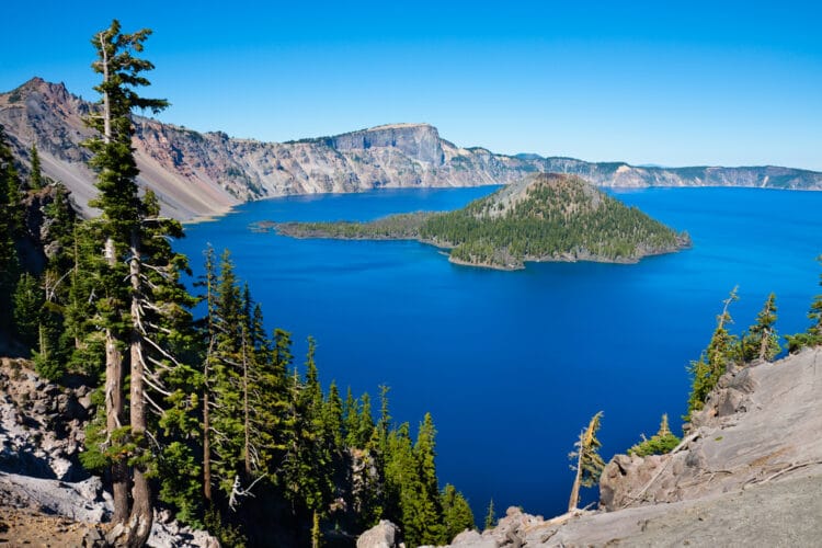
This beautiful stroll hits two birds with one stone as the path will lead you to Sun Notch and Phantom Ship View Point.
Both spots offer beautiful views of Crater Lake along with the unique rock formation, way down in the lake, named The Phantom Ship. Expansive meadows with wildflowers and the opportunity to see wildlife complete this perfect opportunity for photos and to stretch your legs.
Read our guide to the best scenic road trips in Oregon!

Pinnacles Valley Trail
Difficulty: Easy
Length: 1.0 miles
Elevation Gain: 60 ft
Location: Off Rim Road and Pinnacles Road.
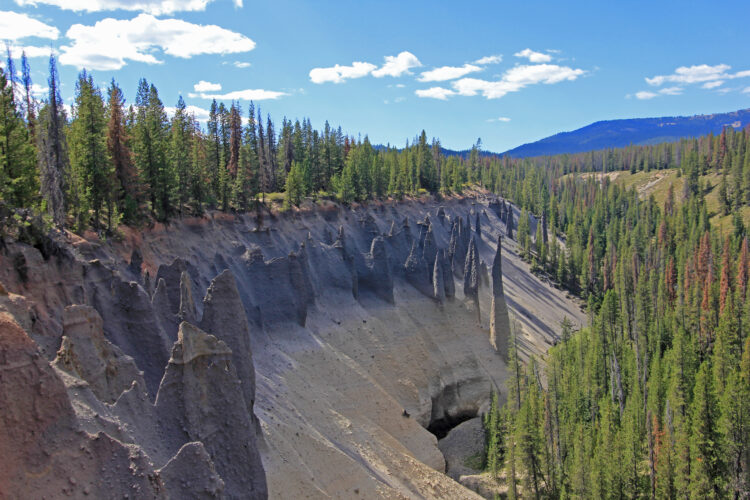
Unique and interesting pinnacle volcanic spires sit along this short and east trail and is one of the best Crater Lake hikes that offers great rewards for little work.
The first ¾ of the trail is wheelchair and stroller accessible making it perfect for families and everything interesting can be seen at this point.
The pinnacles are complete with the surrounding area and valley as its backdrop.
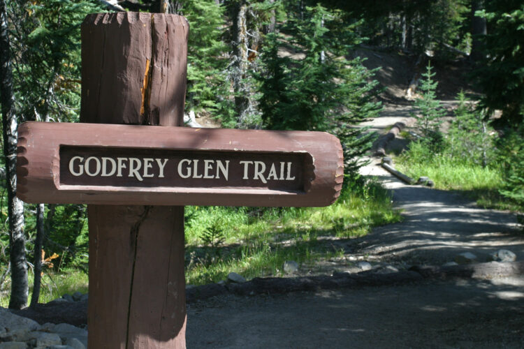
Godfrey Glen Trail
Difficulty: Easy
Length: 1.1 miles
Elevation Gain: 72 ft
Location: Off Munson Valley Drive.
An easy and almost completely flat loop through meadows abundant in wildflowers and butterflies, hiking Godfrey Glen is one of the best things to do in Crater Lake NP. The meadow is surrounded by interesting volcanic pinnacles and a little stream completes the enchanting spot.
Brochures are available at the beginning of the trail for an educational, self-guided tour.
Plaikni Falls
Difficulty: Easy
Length: 2 miles
Elevation Gain: 200 ft
Location: Off Pinnacles Road.
Perfect for all skill levels, this short but highly rewarding hike in Crater Lake NP ends at one of the best waterfalls near Crater Lake. Water is present year-round, but most active in the springtime.
Along the way, beautiful tall trees are home to all types of birds and wildflowers attract butterflies during warm weather.
The well-maintained trail also has multiple benches to stop and rest, giving visitors the chance to stop and really enjoy nature.

Annie Creek Canyon
Difficulty: Easy
Length: 2.1 miles
Elevation Gain: 305 ft
Location: Off HWY 62 near Mazama Village
This well-kept, if dusty during the summer months, trail explores all the beauty that hiking in Crater Lake National Park has to offer.
With clear streams, tall trees, green brush, and wildflowers, you cannot go wrong with this hike. Benches are dotted along the trail in case rest is required or just to to sit and enjoy the sounds of nature for a while.

Discovery Point Trail
Difficulty: Easy
Length: 2.2 miles
Elevation Gain: 100 ft
Location: Out of Rim Village.
This must-do Crater Lake hiking trail is right out of Rim Village and usually open year-round, offering nonstop views of the lake even when surrounded by snow on the cliffs.
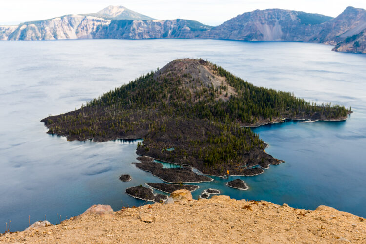
There are especially fantastic views of Wizard Island, a fairly new volcanic cone out on the lake. The family-friendly trail is perfect for all ages and full of interesting information about the lake and park.
The Watchman Lookout Trail
Difficulty: Moderate
Length: 1.6 miles
Elevation Gain: 415 ft
Location: Off Rim Road on west side of Crater Lake.
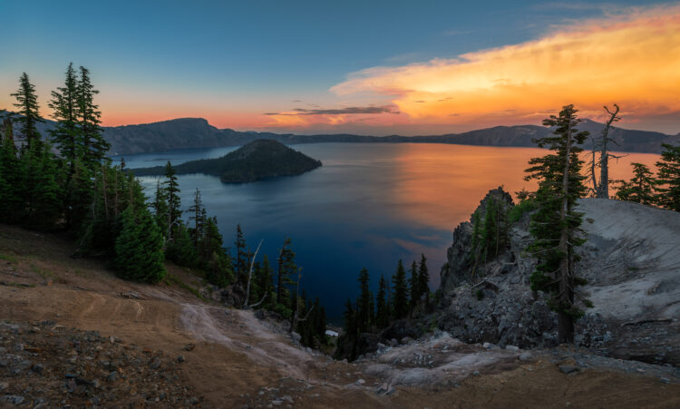
This trail has a bit of a climb to a lookout structure at the very top, but it is well worth it for the views. It is well maintained as it’s the shortest peak hike and therefore quite popular, interesting information is also available at the top.
But the best prize is the commanding views of Crater Lake, Wizard Island, and the surrounding peaks and valleys with views as far as the eye can see.
Cleetwood Cove Trail
Difficulty: Moderate
Length: 2.2 miles
Elevation Gain: 700 ft
Location: Off Rim Road on the north side of Crater Lake.
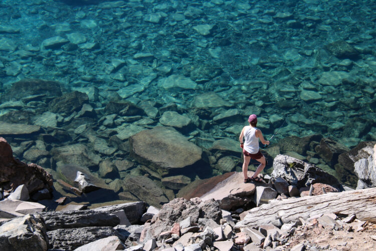
This is the most popular hike in Crater Lake NP, as it is the only access point to the lake and the launch point for boat tours. It is a steep hike down and then quite a climb on the way back with little respite.
However, beautiful lake views reward visitors the entire way. Down at the water’s edge is the perfect spot to swim and soak up the sun.
Garfield Peak Crater Lake Hike
Difficulty: Moderate
Length: 3.4 miles
Elevation Gain: 1100 ft
Location: Out of Rim Village.
360-degree views reward those willing to dare the almost non-stop climb to this viewpoint. Crater Lake stretches below, and surrounding landscapes complete the breathtaking picture.
It is similar to Watchman Lookout, but less crowded and arguably, a more diverse and beautiful hike in Crater Lake National Park.
Mount Scott
Difficulty: Moderate
Length: 5.0 miles
Elevation Gain: 1325 ft
Location: Off HWY 49 on the east side of Crater Lake.
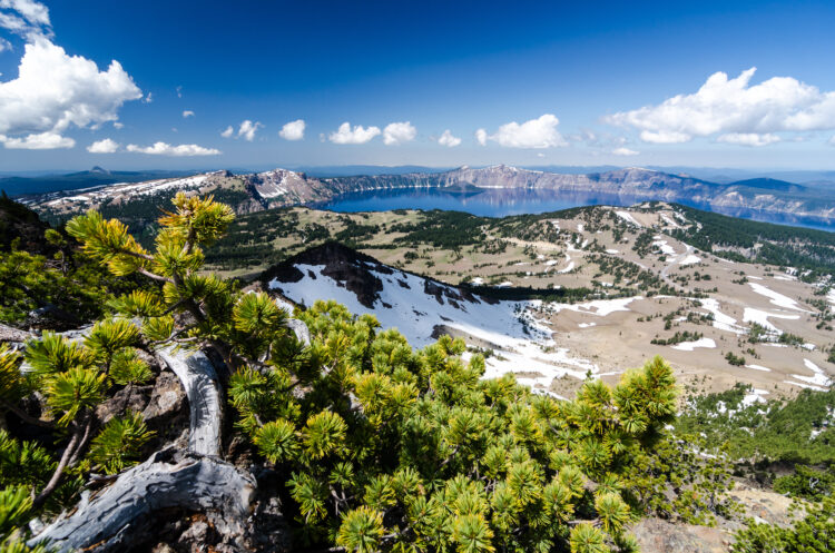
This Crater Lake hiking trail switches back and forth across the mountain, offering a constant view of the lake to distract from the more strenuous hike.
A 360-degree view at the lookout at the top is not disappointing as it is the highest point in the park.
Crater Lake is further in the distance, giving it a stepped-back unique view in perspective of the surrounding area.
Crater Peak Trail
Difficulty: Difficult
Length: 7.0 miles
Elevation Gain: 1184 ft
Location: Vidae Falls Picnic Area.
Unlike many of the other hikes in Crater Lake NP, this trail does not include a view of Crater Lake. Instead, this still-worthwhile destination winds through some beautiful and diverse forest and then up to a peak that will showcase the surrounding landscapes.
Not many people do this hike, so enjoy the peace and quiet of nature. Also, chances of wildlife encounters such as deer are more likely because of the lack of crowds.

Mazama Village to Rim
Difficulty: Difficult
Length: 8.3 miles
Elevation Gain: 1742 ft
Location: Off Munson Valley Road near Mazama Village.
As the name suggests, this trail runs from Mazama Village to Rim Village at the edge of Crater Lake (or vice versa).
This is a stretch of the Pacific Crest Trail, so chances of running into interesting people to chat with are pretty good.
Open year-round, this trail runs right through beautiful meadows and forest with most of the climb near Rim Village.

Union Peak Trail
Difficulty: Difficult
Length: 9.6 miles
Elevation Gain: 1683 ft
Location: Off HWY 62 near Mazama Village.
The Union Peak trail is a rocky outcrop that truly shows the beauty of this volcanic landscape.
Though the climb is tough, the reward at the top is well worth it. Even if fog rolls in, the exciting and eerie, the atmosphere is the perfect photo opportunity.
Use caution on the trail! Though it is well maintained, at some points the trail narrows, and the steep drops can be dizzying.
Stuart Falls Trail
Difficulty: Difficult
Length: 11.7 miles
Elevation Gain: 1440 ft
Location: Off HWY 62 south of Mazama Village.
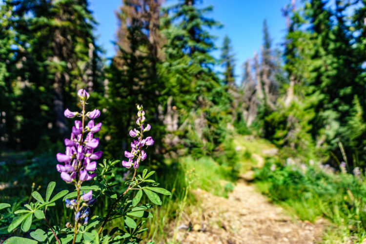
Away from the crowds, this peaceful and quiet hike, if long, is perfect for some solitude. It is also a unique experience as the trail makes its way over a ridge and then down into a valley to end at a dramatic waterfall.
This breaks up the elevation gain well and allows breathtaking views half-way through the hike, a perfect stop to stop and rest.
You May Also Like…
Crater Lake: 10 Best Things to Do in Crater Lake National Park
Washington: 21 Best Hikes in Washington State
Bend: 10 Best Things to Do in Bend, Oregon
